
Sale!


Explorer OL 32 Winchester New Alresford East Meon Map
Original price was: £6.00.£4.20Current price is: £4.20.
- Fast reliable delivery options
- Quality You Can Trust
- Quality and Affordability Combined
- Buy quality, buy with us.

The essential map for outdoor activities in Winchester, New Alresford & East Meon. The OS Explorer Map is the Ordnance Survey’s most detailed folding map and is recommended for anyone enjoying outdoor activities including walking, horse riding and off-road cycling. This map now comes with a digital version which you can download to your smartphone or tablet.
Features
- South Downs
- South Downs Way
- Wayfarer’s Walk
- Clarendon Way
- Three Castles Path
- Oxdrove Way
- Itchen Way
- Monarch’s Way (Book 3)
- Kings Way
- Pilgrim’s Trail
- South Downs Way (National Trail)
- Hampshire
- Eastleigh
- Winchester
- 1:25 000 scale (4 cm to 1 km – 2.5 inches to 1 mile)
- This map comes with a digital version which you can download to your smartphone or tablet
| Choose size in stock | One Size |
|---|
Be the first to review “Explorer OL 32 Winchester New Alresford East Meon Map”
Related products
Sale!


Equipment
Original price was: £17.50.£12.25Current price is: £12.25.
Sale!
Original price was: £6.00.£4.20Current price is: £4.20.
Sale!


Equipment
Original price was: £52.97.£37.08Current price is: £37.08.
Sale!
Original price was: £6.00.£4.20Current price is: £4.20.
Sale!

Equipment
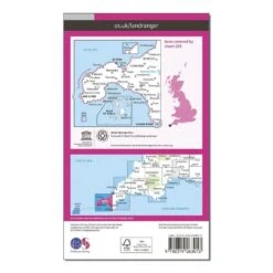
Landranger 203 Land’s End & Isles Of Scilly, St Ives & Lizard Point Map With Digital Version
Original price was: £6.00.£4.20Current price is: £4.20.
Sale!


Equipment
Original price was: £39.00.£27.30Current price is: £27.30.
Sale!


Equipment
Original price was: £108.00.£75.60Current price is: £75.60.
Sale!


Equipment
Original price was: £49.00.£34.30Current price is: £34.30.
Reviews
There are no reviews yet.